Climate Change in Australia
Climate information, projections, tools and data
Data Download Formats
Data are available for download in a number of different file formats:
- NetCDF files: a multi-dimensional file format commonly used in the climate science field.
- .csv files: comma-delimited text files that can be opened directly in Excel.
- Ascii files: NB some of the data from particular modelling groups come in files that are not aligned to a square grid so will not be able to be loaded into ArcGIS in this form. In this case NetCDF files must be used.
Help with exporting data
ArcGIS software is one of the more popular software packages used in the GIS community. Climate model data are most often available as NetCDF files, however these files are not a commonly used GIS format. Here we provide instructions on importation of NetCDF files into ArcGIS software so the files can be manipulated and explored by GIS users.
Procedure
1) Download the required NetCDF data from the Download Datasets page..
2) Import data into ArcGIS
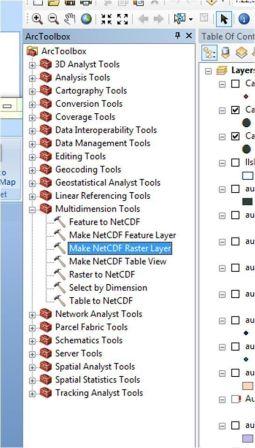
Start an ArcGIS Application, for example, ArcMap and open the ArcToolbox window with the Show/Hide ArcToolbox Window button found on the standard toolbar. Navigate to the Multidimension tools toolbox and access the ‘Make NetCDF Raster layer’ tool (Figure 2).

Figure 2 Location of the ArcGIS importation tool under the ‘Multidimension Tools’ category

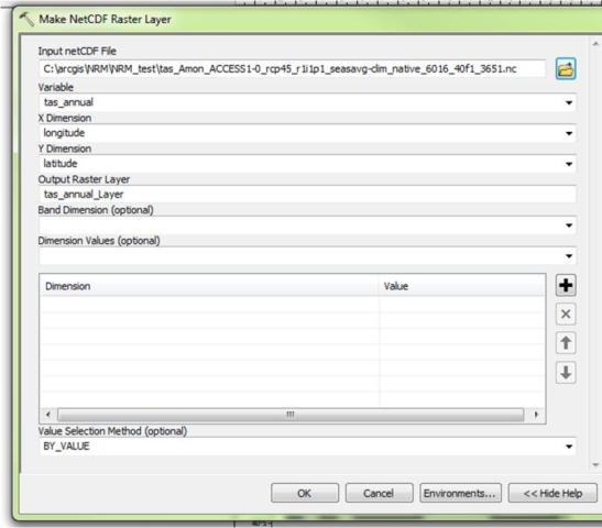
Figure 3 Loading the file into the tool. Select variable from the list. In this case tasmax_annual
3) Visualise the file in ArcMap
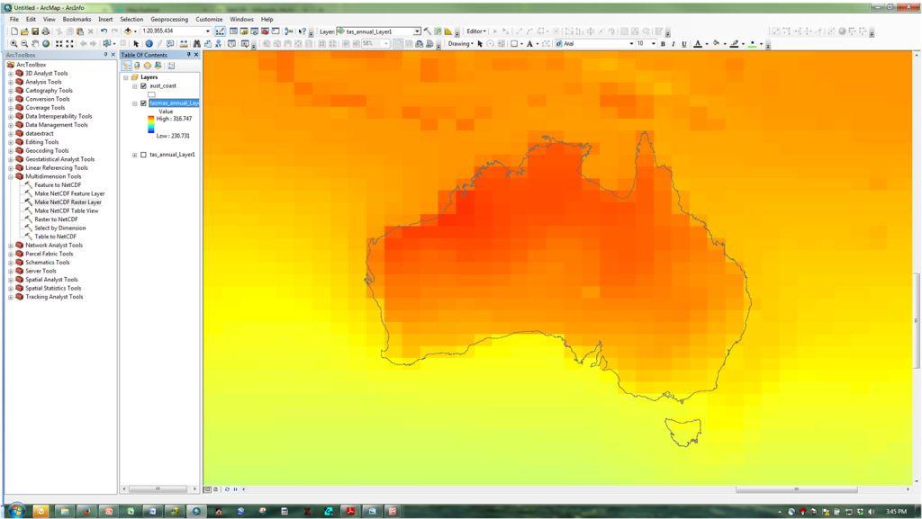
The loaded file can be visualised as in the example in Arc GIS (Figure 4).

Figure 4 The raster file is loaded and visible
Load the NetCDF file into the ‘Make NetCDF Raster Layer’ tool and select the variable of interest e.g. tasmax_annual (Figure 3). It is a good idea to describe the Output Raster Layer with the ‘model name/RCP’ as this is not carried through into the loaded file in ArcGIS.
4) Explore the layers in the NetCDF raster file
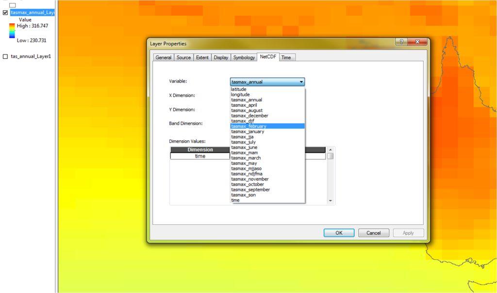
At this point different layers within the file can be viewed (Figure 5). Right click on the map description on the Table of Contents and view the layer properties. In the Layer Properties box, select the NetCDF tab and explore under the variable list to see the different file 'layers' contained in the NetCDF file.

Figure 5 Different layers can be shown by selecting them in the Layers’ Properties information (left), and the visible layer can be exported as a grid (right). In this case Tmax_february is highlighted.
------------
Page updated 24th December 2020


