Climate Change in Australia
Climate information, projections, tools and data

Constructing climate projections – the CSIRO Climate Futures framework
When using climate data sets for an impacts, adaptation & vulnerability (IAV) assessment, there are four important requirements:
- The data must be physically plausible, especially when data for multiple climate variables are being used – in other words, they could occur in the real world (this is referred to being ‘internally consistent’).
- The data must be representative of the range of projections results.
- The amount of data to be used must be manageable.
- Information on likelihood or confidence is available.
One mechanism to satisfy these requirements is the Climate Futures framework (Whetton et al. 2012 ; Clarke et al. 2011 ). This allows the user to view, compare and select model outputs tailored to the needs of a specific application. The example Climate Futures matrix below shows the range of projected changes in winter temperature and rainfall for Gippsland around mid-century (2050s) under high emissions (RCP8.5). The spread of results from multiple climate models is shown on two dimensions divided into categories. The number of models within each category (or ‘climate future’) gives an indication of model agreement on that category.

Representative climate futures can then be selected, where key cases of interest are defined by the vulnerabilities of the application being considered. A representative model simulation from each key case can then be chosen and the data obtained. In the example matrix (to inform a dairy productivity assessment), a hotter, drier climate is considered the worst case and a future that is less hot but wetter is considered the best available climate future for this particular application. For another application, the situation is likely to be different.
The maximum consensus climate future (where there is the greatest model agreement) is also shown. Understanding where there is the maximum consensus among models is useful. In all circumstances, however, the higher impact but less likely best and worst cases should also be considered.
The following steps outline the procedure for creating a Climate Futures matrix, using the Climate Futures Toolkit on the Climate Change in Australia website. However, this process is complex so you may need to seek help. A good place to start is the Introduction to Climate Futures and Understanding the Climate Futures Framework (PDF download) . You can also contact the CSIRO Climate Science Centre .
- Use the Detailed Projections Tool to generate a Climate Futures matrix to explore the range of change in terms of two classifying variables (because of the correlations among variables, temperature and rainfall are usually best classifiers). Populate the matrix with all the variables and seasons that are important to the impact assessment (e.g. winter rainfall and temperature, and summer minimum temperature are often important for the dairy sector).
- Use the information on projected changes to identify the ‘key cases’ that are important for the impact assessment. Commonly these are best case, worst case and maximum consensus (e.g. Figure 62). If needed, a simple sensitivity analysis (see section 7.3.1) can be useful to guide this step.
- Identify a representative model for each key case.
- Rank the models using the Climate Futures Tool Representative Model Wizard
- Follow the guidance on the Climate Futures matrix display to reject any models that have been identified as performing poorly for any reason in the region of interest. This is very important since you will be using data from a single model to represent the relevant key case.
- Obtain the data needed from each model. In many cases, the data will be available on Climate Change in Australia, including data from VCP19. However, once the representative models have been identified, the data from those models may be available from a range of sources (take care to ensure data from other sources are comparable to those used by Climate Futures).
- Input the data into the impact assessment.
- If using a risk management approach, use the information on model consensus (from the matrix) to guide the assessment of likelihood.

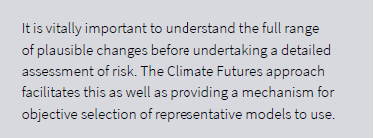
In VCP19, we present data from new high-resolution (5 km) modelling alongside previous modelling datasets – and highlight where the new data add useful insights. When assessing risk, it is important to consider the full range of plausible changes, especially if worst-case or other ‘low probability, high impact’ cases are important to manage or mitigate. The Climate Futures approach makes it easy to choose representative climate futures from across all available data sources.
For Victoria, we suggest using the VCP19 datasets in preference to the GCM datasets in most instances (this is because the VCP19 data have been shown to add value to the GCM results). However, if one of the key cases (as described above) is projected only by GCMs, we suggest the GCM results should be used unless there is a compelling reason not to. This is because it is generally more important to evaluate a plausible extreme case than it is to have higher spatial resolution.
A final consideration in model selection is the availability and usability of the necessary data. The range of climate variables and data formats available from GCMs and RCMs varies among models. GCM outputs and detailed dynamically downscaled data sets are available as described below. If other types of data are really needed (e.g. from weather generators or other forms of statistical downscaling), then this can be pursued. These methods, however, can be time-consuming and costly and require specialised skills to produce.
Sensitivity analysis
A sensitivity analysis is a good starting point in an impact assessment process and requires no detailed climate projection inputs.
A sensitivity analysis involves testing the effect of a spectrum of changes to a system – e.g. +1, +2, +3 and +4°C or -20, -10, +10 and +20% rainfall – to look for relationships, sudden changes or thresholds in response to climate changes. The results can in turn be used to define best and worst cases for use in Climate Futures.
For example, if a sensitivity test reveals a threshold of -20% in rainfall where a particular system must transform or face failure, this can be explored as the worst case in Climate Futures. The chance of reaching this threshold under different RCPs and timeframes across the model range can then be explored.
Spatial analogues
Spatial climate analogues can be another useful tool to start assessing what climate change means by looking at places that currently experience the climate that is projected to occur in the area in question, e.g. Melbourne’s climate becoming more like the current climate of Wangaratta.
Such spatial analogues can be explored using the Climate Analogues Explorer .
------------
Page updated 24th December 2020