Climate Change in Australia
Climate information, projections, tools and data

Getting Started
In these pages, we provide brief guidance about using climate projections information for the purpose of impact, adaptation and vulnerability (IAV) assessments, as part of the broader response to climate change. The decision tree shown below can help determine which data and information from VCP19 and elsewhere might be useful for a given application.
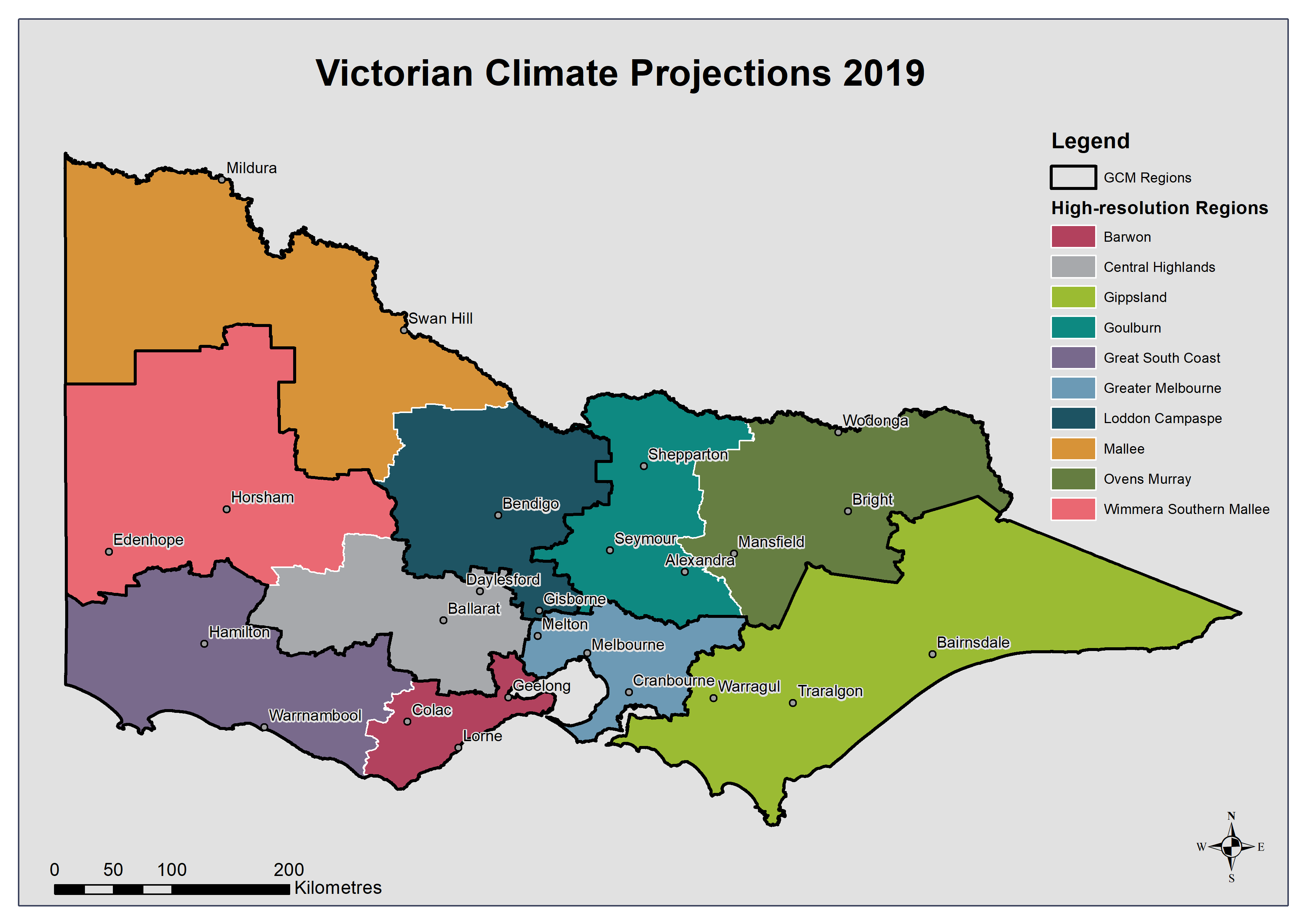
Not all applications will require access to detailed climate data sets. VCP19 has produced a detailed Technical Report, easy to read Regional Reports for each of the ten regions (see map, below) and a range of Fact Sheets. These are all available as PDF downloads from the VCP19 Publications page
.
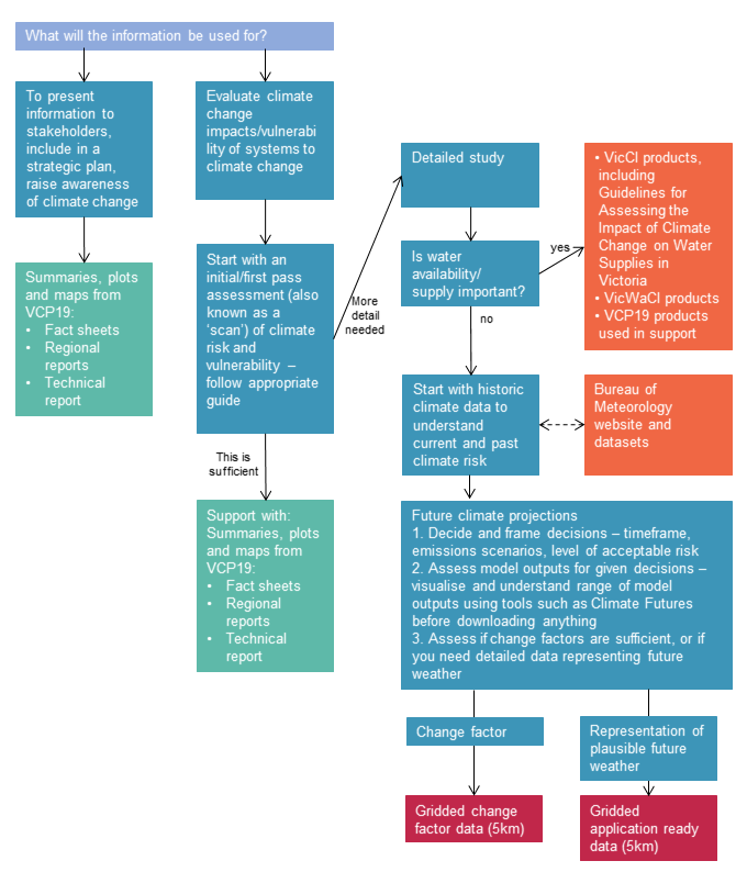

![]() VCP19 Decision Tree (167.7 KB)
VCP19 Decision Tree (167.7 KB)
------------
Page updated 24th December 2020